Приколы, юмор, анекдоты, фото, картинки, все самое смешное и интересное только здесь!
Наша планета, вид сверху
126 новых фотографий сделал Yann Arthus-Bertrand облетая нашу планету на вертолете в очередной раз.
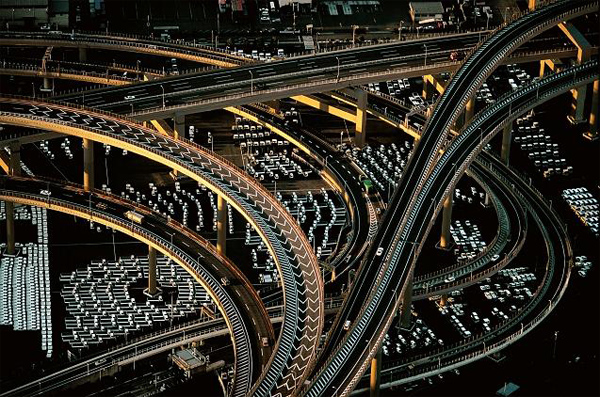
Freeway interchange near the port of Yokohama, Honshu, Japan (35°27’ N, 139°41’ E).
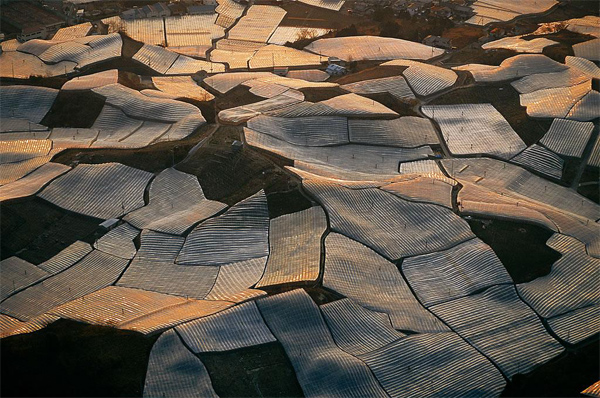
Greenhouses between Nara and Osaka, Honshu, Japan (34°37’ N, 135°41’ E).
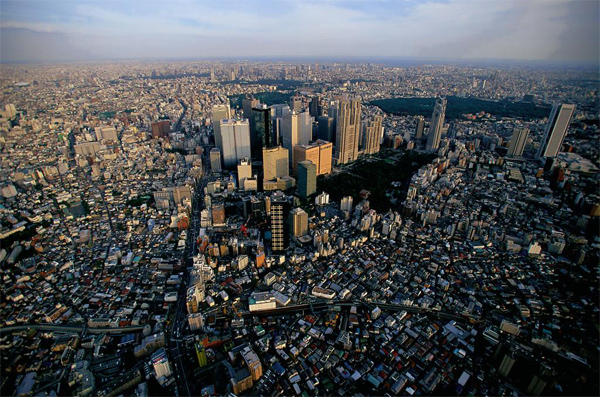
Shinjuku district of Tokyo, Japan (35°41’ N, 139°42’ E).

Cattle-raising near Fukayama (east of Hiroshima), Honshu, Japan (34°31’ N, 133°20’ E).

Shopping district in Tokyo, Honshu, Japan (35°42’ N, 139°46’ E).
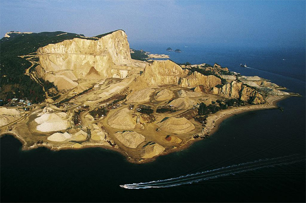
Quarry on an island of Ieshima archipelago, Inland Sea, Japan (34°40’ N, 134°31’ E).
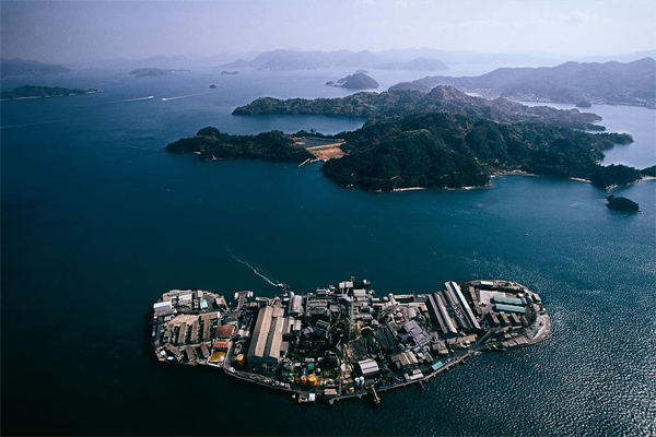
Factory on an island east of Hiroshima, Honshu, Japan (34°10’ N, 132°41’ E).
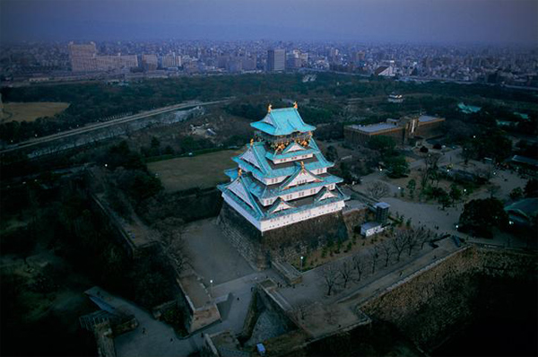
Osaka Palace, Honshu, Japan (34°41’ N, 135°31’ E).
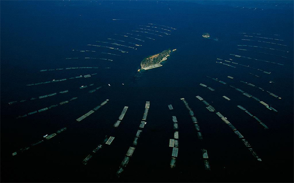
Fishermen’s island in Hiroshima Bay, Honshu, Japan (34°18’ N, 132°24’ E).
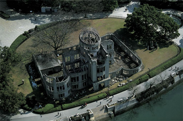
The Genbaku Dome, epicenter of the 1945 atom bomb explosion, Hiroshima, Honshu, Japan (34°24’ N, 132°27’ E).
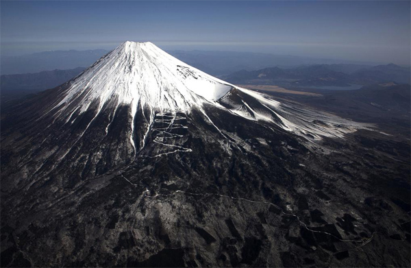
Mount Fuji, Honshu, Japan (35°21’ N - 138°44’ E).
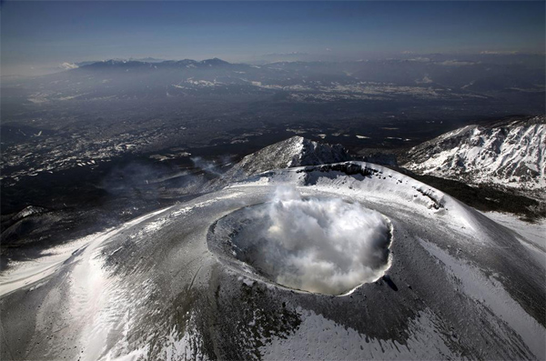
Mount Asama , Honshu, Japan
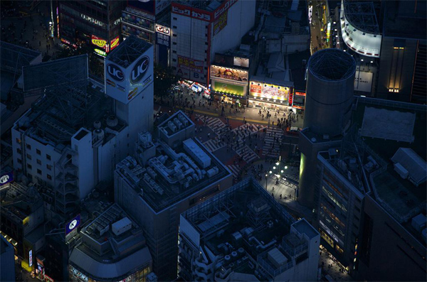
Illuminated streets in Tokyo, Shibuya-Ku, Tokyo, Honshu, Japan (35°40’ N, 139°42’ E).
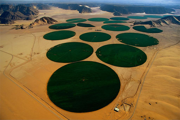
Center-pivot irrigation, Ma’an, Jordan (29°36’N – 35°34’E).
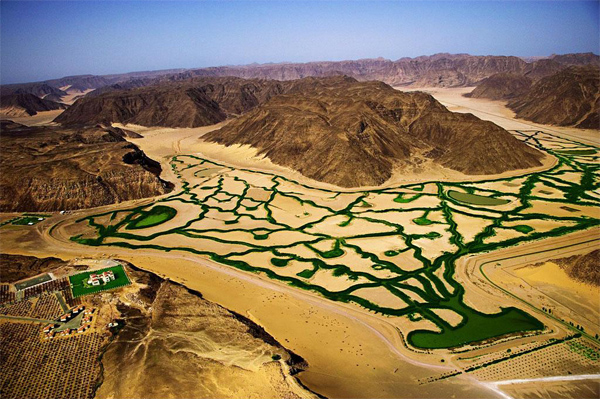
Canals and a formal garden in the desert, Jordan (29°33’N - 35°39’E).
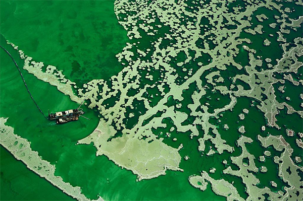
Boat on the Dead Sea near a potash plant, Al Karak region, Jordan (30°50’N, 35°30’ E).
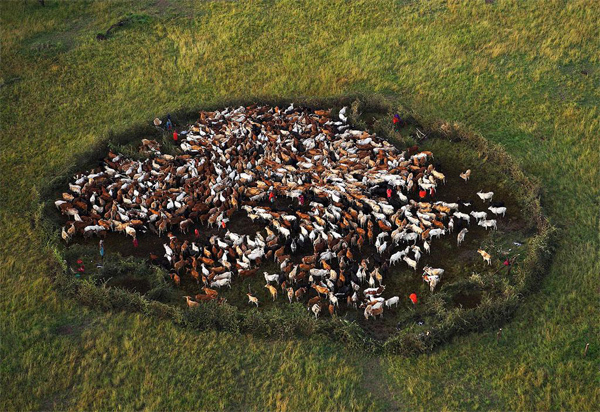
Masai cattle pan near Masai Mara National Reserve (1°13’ S – 35°00’ E).
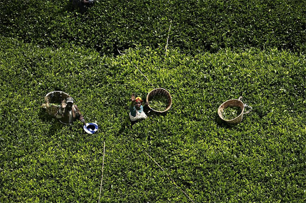
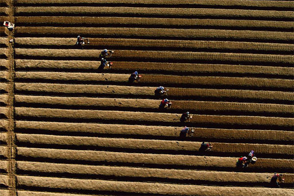
Tea picking, Kericho region, Kenya (0°20’ S – 35°15’ E).
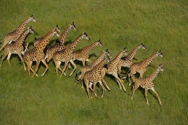
Giraffes in the Meru National Park, Kenya (N 0°10’ - E 38°15’).
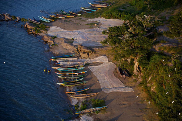
Boats on the banks of Lake Victoria, Kenya (0°09’ S – 4°37’ E).
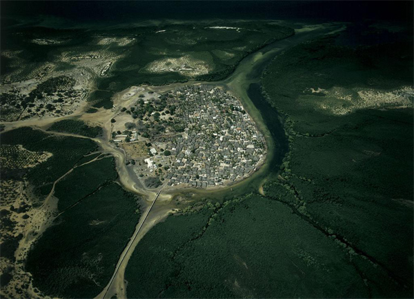
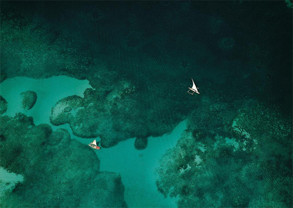
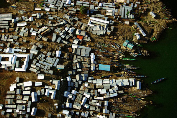
The village of Faza, Lamu, Kenya (S 2°16’ - E 40°54’).
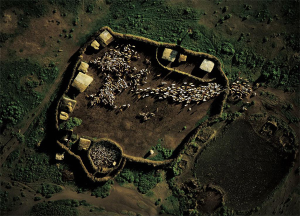
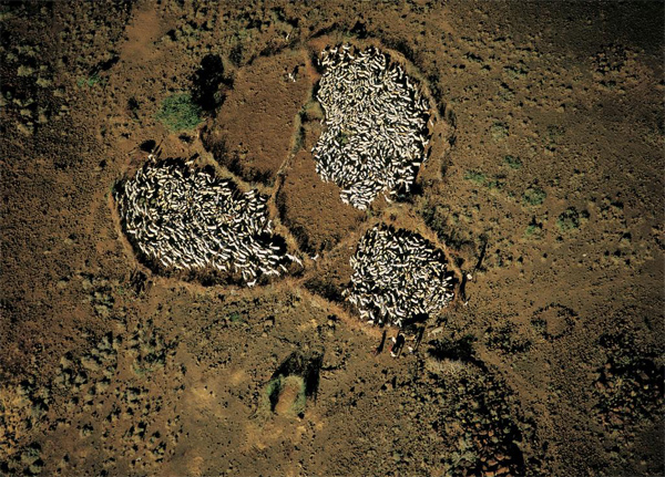
Masai village enclosure south of Narok, Rift Valley, Kenya (S 1°05’ - E 35°52’).

GREATER FLAMINGOS ON LAKE NAKURU, KENYA (0°17’ S, 36°04’ E).
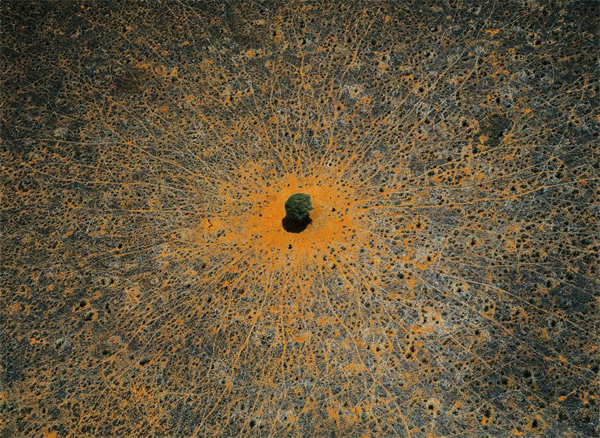
“Tree of life”, Tsavo national park, Kenya (2°11’ S, 38°25’ E).
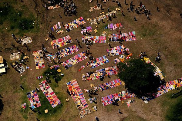
MARKET NEAR THE NATIONAL RESERVE OF MASAI MARA, Kenya (S 1°14’ E 34°48’).
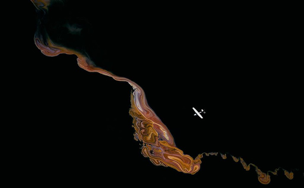
CRYSTALLINE FORMATION ON LAKE MAGADI, Kenya (N 63°54’ W 22°25’).
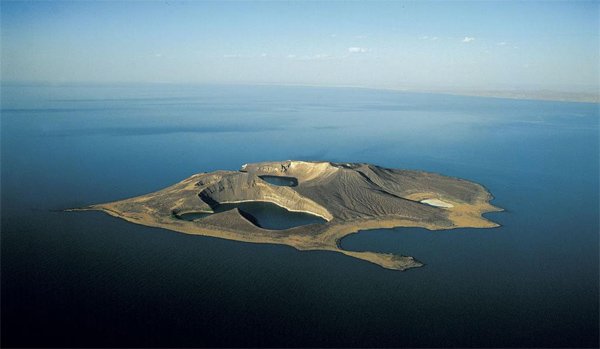
Island in the middle of Lake Turkana, Kenya (N 3°30’ -E 36°05’).
Rendille enclosure between Lake Turkana and Marsabit, Kenya (N 2°20’ - E 37°10’).
Mida Creek, south of Malindi, Kenya (S 3°15’ - E 40°10’).
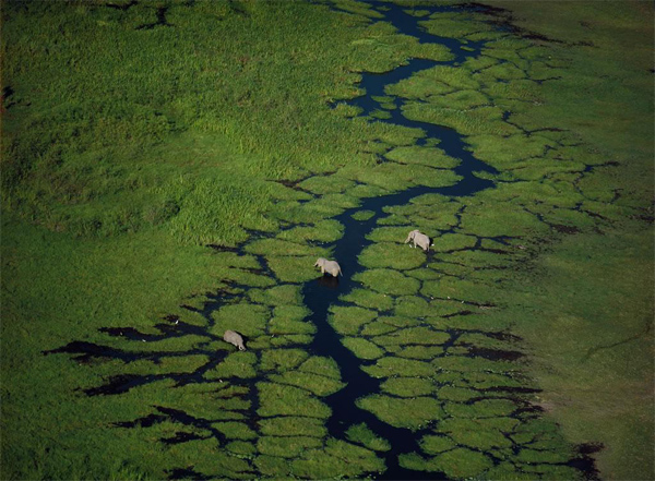
Elephants in the Meru National Park, Kenya (N 0°10’ - E 38°15’).

Sugar mill, Kenya (1°00’ N – 38°00’ E).
Tea planting, Kericho region, Kenya (0°20’ S – 35°15’ E).
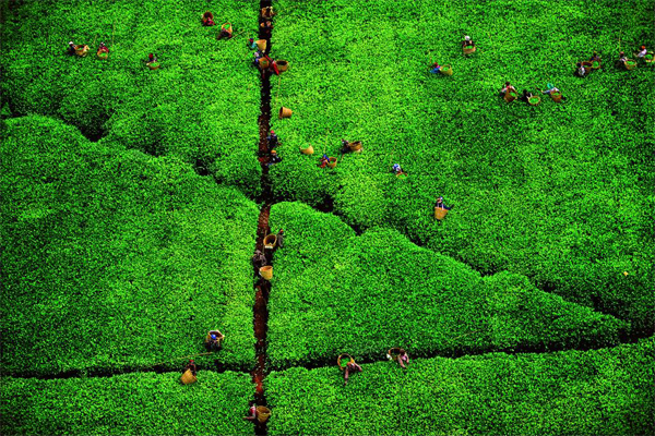
Tea picking, Kericho region, Kenya (0°20’ S – 35°15’ E).
Fishing Village, Lake Victoria, Kenya (0°27’S, 33°56’E).

White corn store in the Meru National Park, Kenya (N 0°10’ - E 38°15’).
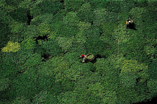
Tea picking, Kericho region, Kenya (0°20’ S – 35°15’ E).
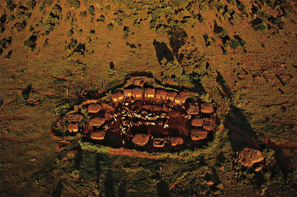
Masai village enclosure, near Kichwa Tembo camp, Kenya (1°13’ S – 35°00’ E).
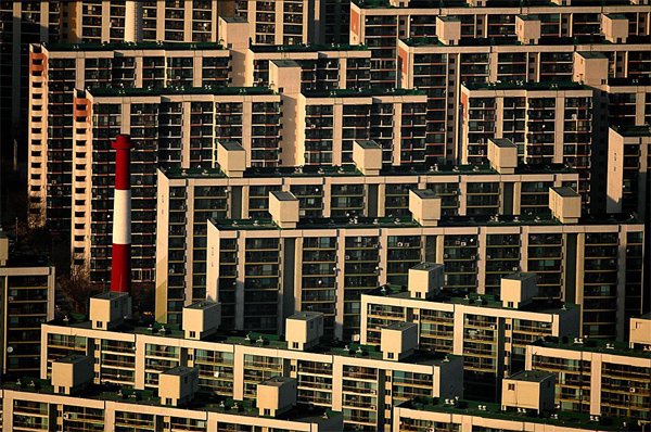
Building on the bank-south of Seoul, South Korea (37°33’N -126°58’E).
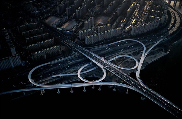
Motorway exchanger on the Han river, Seoul, South Korea (37°33’ N - 126°58’ E).
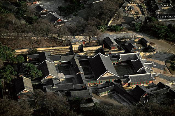
Temple in Seoul, South Korea, (37°33’ N - 126°58’ E ).
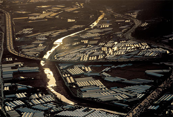
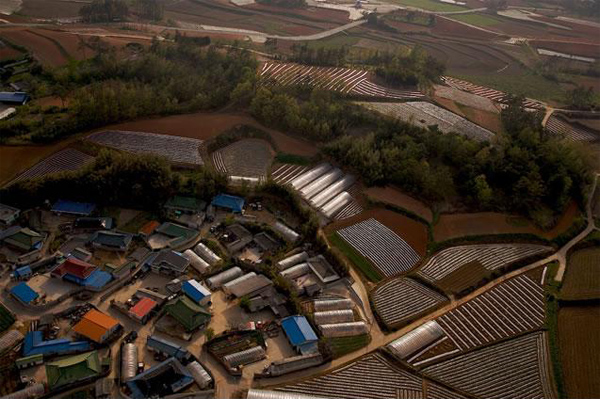
Market-gardening greenhouses in the south-east of Seoul, South Korea (37°33’ N - 126°58’ E ).
Traditional houses district in Seoul, South Korea, (37°33’ N - 126°58’ E ).
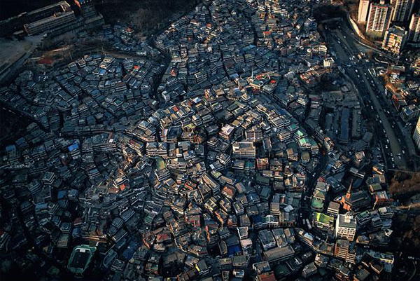
Traditional houses district in Seoul, South Korea, (37°33’ N - 126°58’ E ).
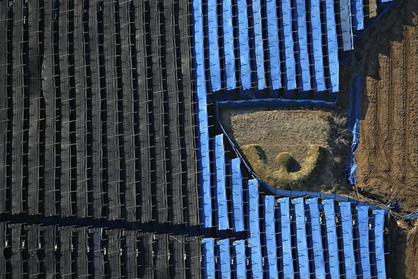
Ginseng farming north of Pochon Gun, Kyonggi-do province, South Korea (38°10’ N, 127°15’ E).
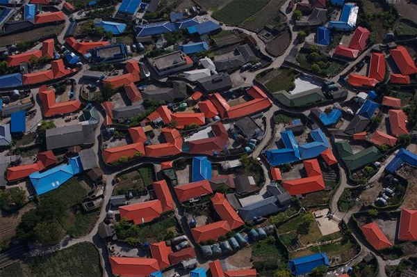
Rural village of Buk Peong, South Korea (34°40’ N, 126°50’ E).
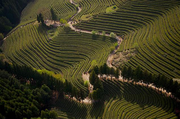
Tea cultivation, Posong, South Korea,(34°47’ N - 127°04 E).
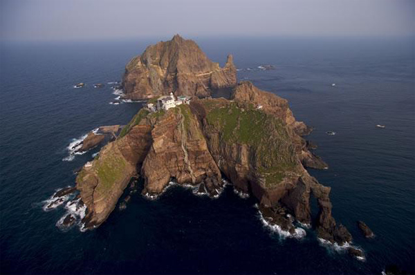
Dokdo Islands ( Liancourt rock ), South Korea (37°14’ N - 131°52’ E).
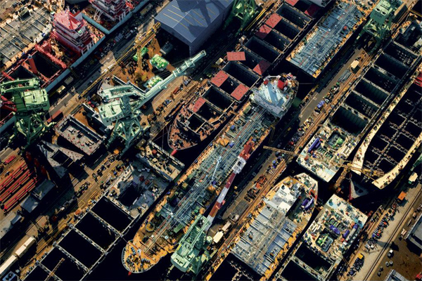
Ulsan shipyard, South Korea (35°32’ N, 129°19’ E).
Ginseng fields near Cheorwon, Gangwon Province, South Korea (38°14’ N, 127° 12’ E).
Комментарии (0)
RSS свернуть / развернутьТолько зарегистрированные и авторизованные пользователи могут оставлять комментарии.